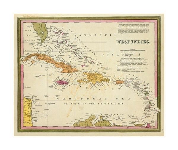
Map 2: West Indies, 1846
Item
Collection number: Map 2
Scope and Contents
! map : color ; 28 x 35 cm Publisher: Philadelphia , PA : Mitchell, S. Augustus (Samuel Augustus) 1792-1868 Scale: 1 : 7,500,000 Framed Appears in A New Universal Atlas, 1846. Map shows southern half of Florida,a section of Guatemala, the West Indies, and a small area of northern South America.Includes list of the West Indies Islands and the pocessions of the European powers. Prime meridian is Greenwich.
Dates
- Created: 1846
Creator
- From the Collection: Mitchell, S. Augustus (Samuel Augustus), 1792-1868 (Cartographer, Person)
- From the Collection: Stuart, Oliver J. (Cartographer, Person)
- From the Collection: Lewis, Samuel (Cartographer, Person)
- From the Collection: Bellin, Jaques Nicolas, 1703-1772 (Cartographer, Person)
- From the Collection: Cram, George Franklin, 1841-1928 (Cartographer, Person)
- From the Collection: Jeffreys, Thomas, -1771 (Cartographer, Person)
- From the Collection: Ruscell, Girolamo, -approximately 1565 (Cartographer, Person)
- From the Collection: Sanuto, Gulio, 1520-1576 (Cartographer, Person)
- From the Collection: Sanuto, Livio, 1520-1576 (Cartographer, Person)
Conditions Governing Access
This collection is open for research.
Extent
From the Collection: 13.00 items
Language
From the Collection: English
Repository Details
Part of the Valdosta State University Archives and Special Collections Repository
Contact:
Valdosta State University Archives, Odum Library
1500 N. Patterson St.
Valdosta GA 30601 United States
7063728116
229-259-5055 (Fax)
archives@valdosta.edu
Valdosta State University Archives, Odum Library
1500 N. Patterson St.
Valdosta GA 30601 United States
7063728116
229-259-5055 (Fax)
archives@valdosta.edu