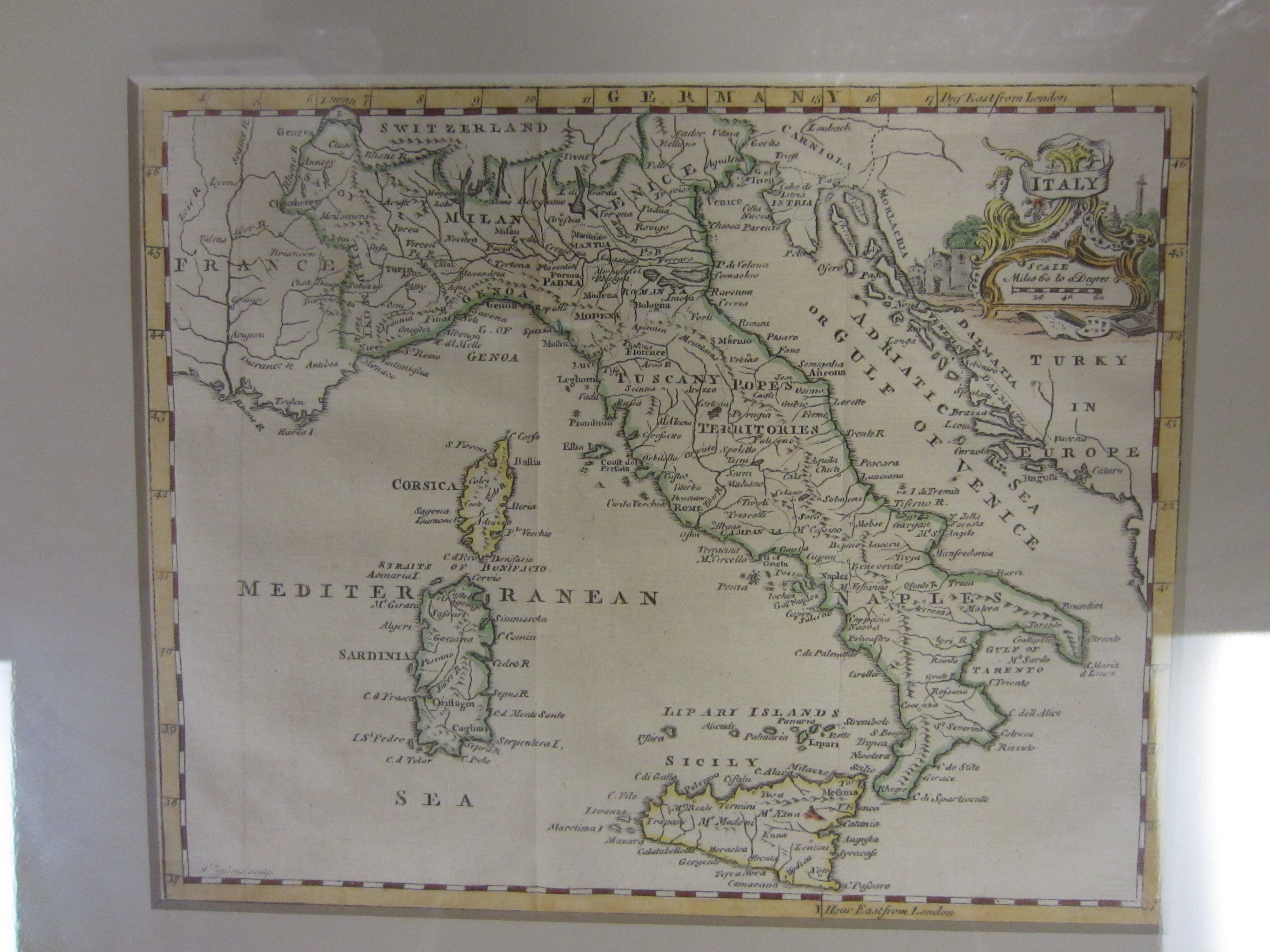
Map 11: Italy (including Corsica, Sardinia and Sicily), ca 1749
Item
Collection number: Map 11
Scope and Contents
1 map : colored ; 7.5" x 9.5" Creator: Jefferys, Thomas, -1771 Framed Cartouche and borders of countries colored. Published in different atlases from 1748-1786.
Dates
- ca 1749
Creator
- From the Collection: Mitchell, S. Augustus (Samuel Augustus), 1792-1868 (Cartographer, Person)
- From the Collection: Stuart, Oliver J. (Cartographer, Person)
- From the Collection: Lewis, Samuel (Cartographer, Person)
- From the Collection: Bellin, Jaques Nicolas, 1703-1772 (Cartographer, Person)
- From the Collection: Cram, George Franklin, 1841-1928 (Cartographer, Person)
- From the Collection: Jeffreys, Thomas, -1771 (Cartographer, Person)
- From the Collection: Ruscell, Girolamo, -approximately 1565 (Cartographer, Person)
- From the Collection: Sanuto, Gulio, 1520-1576 (Cartographer, Person)
- From the Collection: Sanuto, Livio, 1520-1576 (Cartographer, Person)
Conditions Governing Access
This collection is open for research.
Extent
From the Collection: 13.00 items
Language
From the Collection: English
Repository Details
Part of the Valdosta State University Archives and Special Collections Repository
Contact:
Valdosta State University Archives, Odum Library
1500 N. Patterson St.
Valdosta GA 30601 United States
7063728116
229-259-5055 (Fax)
archives@valdosta.edu
Valdosta State University Archives, Odum Library
1500 N. Patterson St.
Valdosta GA 30601 United States
7063728116
229-259-5055 (Fax)
archives@valdosta.edu