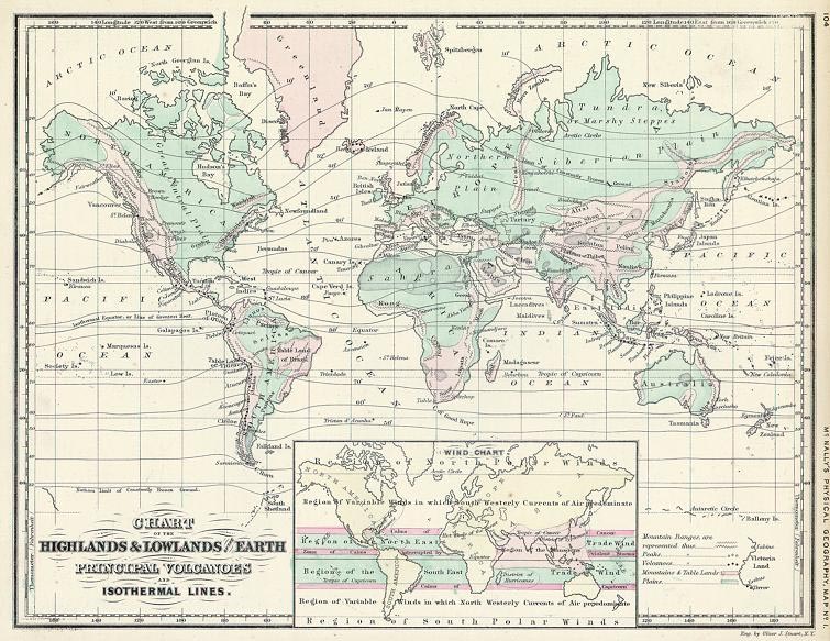
Chart of the Ocean and Continental Basins And Chart of the Highlands and Lowlands of the Earth
Digital Record
Collection number: Map 3
Dates
- c 1850
Creator
- Stuart, Oliver J. (Person)
- McNalley (Family : McNalley, Francis ) (Family)
Rights Statement Note
Educational
Physical Description Note
2 maps : color ; 21.02 x 27 cm From : McNally's system of gepgraphy / by Francis McNally, New York : A.S. Barnes & Co,, 1860 Engraver : Stuart, Oliver Framed
Publisher Note
Publisher: Valdosta State University Archives and Special Collections
Contributor Note
Contributor: Victoria Pennington
Repository Details
Part of the Valdosta State University Archives and Special Collections Repository
Contact:
Valdosta State University Archives, Odum Library
1500 N. Patterson St.
Valdosta GA 30601 United States
7063728116
229-259-5055 (Fax)
archives@valdosta.edu
Valdosta State University Archives, Odum Library
1500 N. Patterson St.
Valdosta GA 30601 United States
7063728116
229-259-5055 (Fax)
archives@valdosta.edu