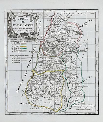
Judee ou Terre Sainte (Judea or Holy Land)
Digital Image
Collection number: aftb02
Physical Description Note
Map of Judea and the Holy Land showing twelve tribal divisions. Copperplate engraving with cartouche. Cartographer: Robert de Vaugondy. 10" x 8 7/8"
Publisher Note
Publisher: Valdosta State Archives and Special Collections
Contributor Note
Contributor: Andrew and Kathy Tatler-Burgess
Repository Details
Part of the Valdosta State University Archives and Special Collections Repository
Contact:
Valdosta State University Archives, Odum Library
1500 N. Patterson St.
Valdosta GA 30601 United States
7063728116
229-259-5055 (Fax)
archives@valdosta.edu
Valdosta State University Archives, Odum Library
1500 N. Patterson St.
Valdosta GA 30601 United States
7063728116
229-259-5055 (Fax)
archives@valdosta.edu