Terre Sainte (Palestine and the Twelve Tribes)
Dates
- 1750
Creator
- Johann Christoph Harenberg (Person)
- Homann Heirs (Organization)
Rights Statement Note
Educational
Physical Description Note
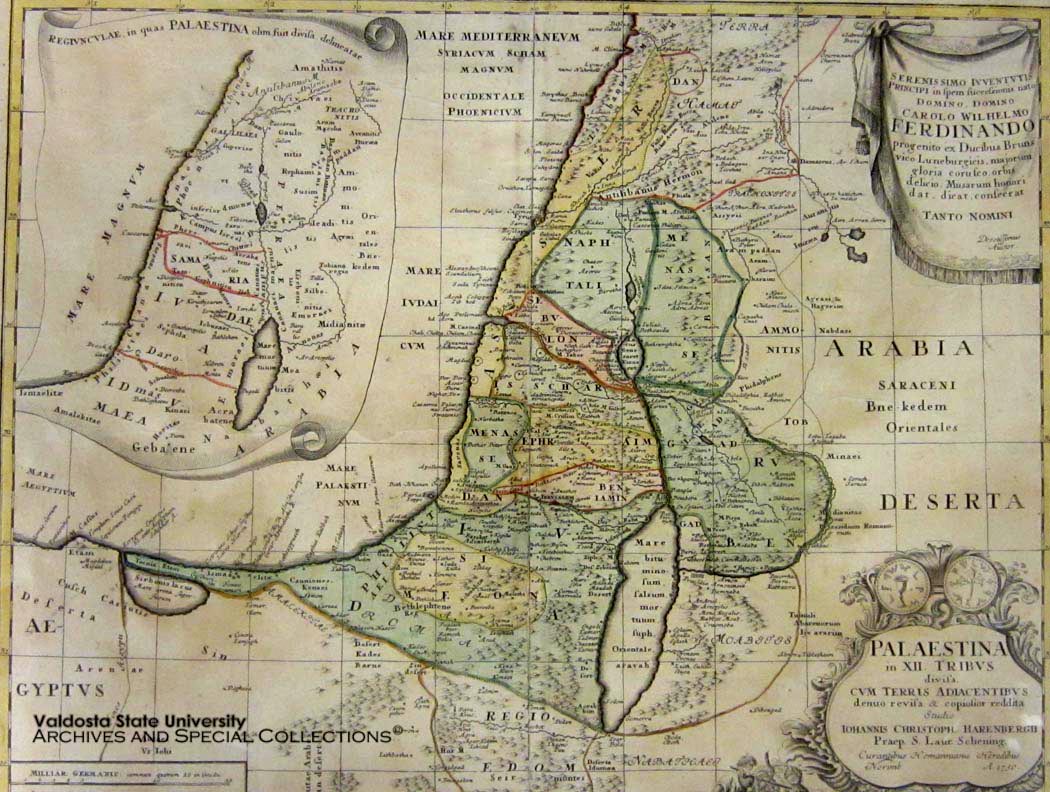
"Terre Sainte" Copperplate engraving map of Holy Land showing 12 tribes of Israel. Non-contemporary hand colored. Cartouche b/w of Palestine. Plate: 19 1/2" x 20 1/2". Framed. Great condition. Published by Homann Heirs Publishers, this map depicts the region of Palestine divided into the 12 tribes of Israel. In the right hand corners there are two title cartouches. The lower is exceptionally decorative and depicts two spies of Moses bearing the fruit from the Promised Land to the Hebrew camp, as well as the front and back of an ancient shekel coin. The upper left quadrant offers an overview of the region as a whole. The upper right features a dedication from the mapmaker to Karl Wilhelm Ferdinand, the future Prince of Braunschweig-Wolfenbüttel and Duke of Braunschweig-Lüenberg. This map was originally drawn by Johann Christoph Harenberg.
Publisher Note
Publisher: Valdosta State University Archives and Special Collections
Contributor Note
Contributor: Andrew and Kathy Tatler-Burgess
Repository Details
Part of the Valdosta State University Archives and Special Collections Repository
Valdosta State University Archives, Odum Library
1500 N. Patterson St.
Valdosta GA 30601 United States
7063728116
229-259-5055 (Fax)
archives@valdosta.edu