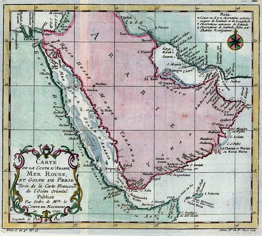
Carte de la Coste D'Arabie, Mer Rouge, et Golfe de Persia. (Map of the Coast of Arabia, Red Sea, and the Persian Gulf)
Physical Description Note
Map of Arabian Peneisula, the Red Sea, and the Persian Gulf. Copperplate engraving, non-contemporary color. 9" x 10". This map is one of the first detailed maps made of the area. Cartographer:Jacques Nicolas Bellin. Bellin was a Hydrographer in the French Dépot de La Marine where he was appointed the first 'Ingenieur hydrographe de La Marine'. He was also named Official Hydrographer of the French King and a member of the Royal Society in London. There is a decorative cartouche in the lower left and compass rose in the upper right along with Bellin's notations on how he located places by astronomical or other means.
Publisher Note
Publisher: Valdosta State University Archives and Special Collections
Contributor Note
Contributor: Andrew and Kathy Tatler-Burgess
Repository Details
Part of the Valdosta State University Archives and Special Collections Repository
Valdosta State University Archives, Odum Library
1500 N. Patterson St.
Valdosta GA 30601 United States
7063728116
229-259-5055 (Fax)
archives@valdosta.edu