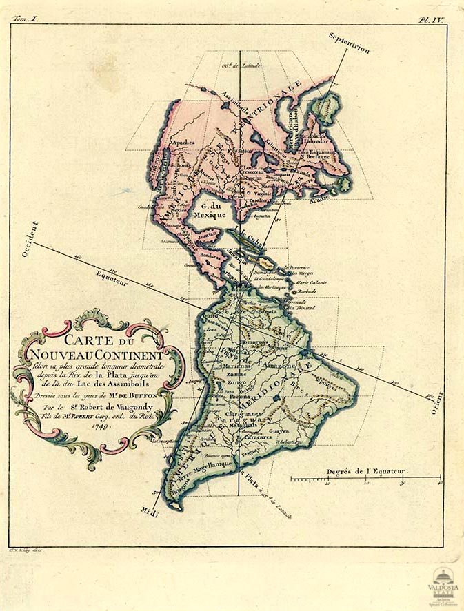
Carte de Nouveau Continent (Map of the New World)
Digital Image
Collection number: AFTB33
Physical Description Note
Map of North and South America according to its greatest diameter length from the Riv. de la Plata to beyond the Lake Assmiboils: prepared under the eyes of M. de Buffonhand. Copperplate non-contemporary hand-colored. 9" x 7 1/8". Cartographer: Robert de Vogaundy.
Publisher Note
Publisher: Valdosta State University Archives and Specials Collections
Contributor Note
Contributor: Andrew and Kathy Tatler-Burgess
Repository Details
Part of the Valdosta State University Archives and Special Collections Repository
Contact:
Valdosta State University Archives, Odum Library
1500 N. Patterson St.
Valdosta GA 30601 United States
2293337150
229-259-5055 (Fax)
archives@valdosta.edu
Valdosta State University Archives, Odum Library
1500 N. Patterson St.
Valdosta GA 30601 United States
2293337150
229-259-5055 (Fax)
archives@valdosta.edu