Monde, 1787
Physical Description Note
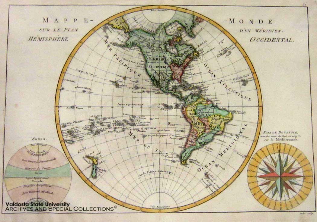
Copper plate engraving, non-contemporary hand colored map of North and South America. Compass rose with names and usage. Plate: 10" x 14 1/2" Framed. Prime Meridian through Paris. Cartographer: Rigobert Bonne. Engraver: Andre. In 1773, Rigobert Bonne (1727-1795) he was appointed Royal Cartographer to France in the office of the Hydrographer at the Depot de la Marine. His attention to detail and accuracy along with his practical aesthetics were a departure from the decorative and artistic cartography of the 17th and early 18th century and made him one of the most important map makers of the modern era. This map was published in Paris in 1787. It includes updates provided by James Cook for Hawaii, New Zealand and the northwest coast of America. The United states is shown confined to east of the Mississippi River. In the lower left is a diagram of the shape of a hemisphere showing the poles. The lower right has a compass known as a “Rose de Boussole.”
Publisher Note
Publisher: Valdosta State University Archives and Special Collections
Contributor Note
Contributor: Andrew and Kathy Tatler-Burgess
Repository Details
Part of the Valdosta State University Archives and Special Collections Repository
Valdosta State University Archives, Odum Library
1500 N. Patterson St.
Valdosta GA 30601 United States
7063728116
229-259-5055 (Fax)
archives@valdosta.edu