Amerique Septentrionale (North America)
Physical Description Note
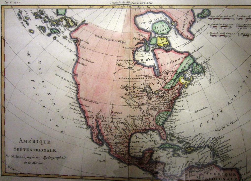
Copper plate antique Map of North America. Non contemporary hand colored. Prime Meridian through Paris. Seven scales of distance. Cartographer: Rigobert Bonne Map appeared in several publications including Rigobert Bonne's own Atlas Encyclopedia. Includes identification of the eastern part of the United States and Canada, Mexico and the Caribbean Sea. The unexplored area of northwestern America are left blank. The interior of the continent features some rivers and Native American tribes. The west coast of North America is very primitive and appears to not include information from Cook's third voyage. In 1773, Rigobert Bonne (1727-1795) was appointed Royal Cartographer to France in the office of the Hydrographer at the Depot de la Marine. His attention to detail and accuracy along with his practical aesthetics were a departure from the decorative and artistic cartography of the 17th and early 18th century and made him one of the most important map makers of the modern era. Location: On display in Vice President's Office, West Hall. December 2013.
Publisher Note
Publisher: Valdosta State University Archives and Special Collections
Contributor Note
Contributor: Andrew and Kathy Tatler-Burgess
Repository Details
Part of the Valdosta State University Archives and Special Collections Repository
Valdosta State University Archives, Odum Library
1500 N. Patterson St.
Valdosta GA 30601 United States
2293337150
229-259-5055 (Fax)
archives@valdosta.edu