England & Wales
Digital Image
Collection number: aftb95a
Dates
- Digitized: 1870
Rights Statement Note
Educational
Physical Description Note
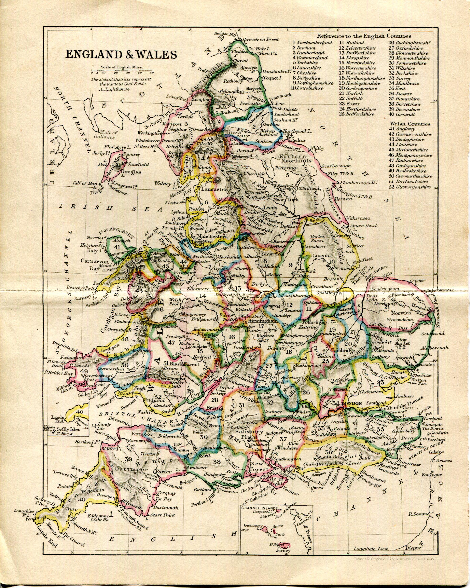
Map of England & Wales divided by Counties (English & Welsh). Hand colored. Drawn & engraved by I. Dower. Pentonville. 8" X 6 1/2"
Publisher Note
Publisher: Valdosta State University and Special Collections
Contributor Note
Contributor: Andrew and Kathy Tatler-Burgess
Repository Details
Part of the Valdosta State University Archives and Special Collections Repository
Contact:
Valdosta State University Archives, Odum Library
1500 N. Patterson St.
Valdosta GA 30601 United States
7063728116
229-259-5055 (Fax)
archives@valdosta.edu
Valdosta State University Archives, Odum Library
1500 N. Patterson St.
Valdosta GA 30601 United States
7063728116
229-259-5055 (Fax)
archives@valdosta.edu