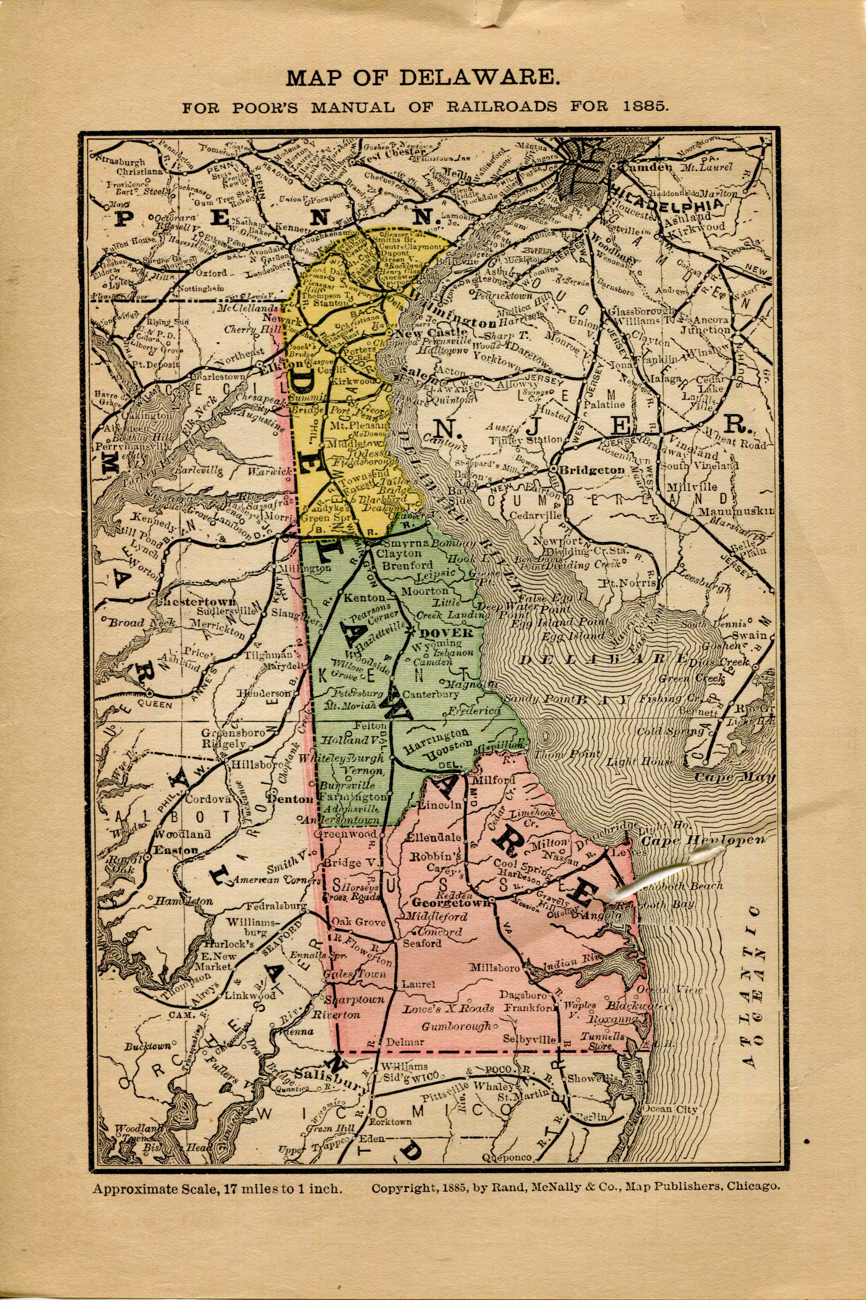
Map of Delaware
Digital Image
Collection number: Map_of_Delaware

Dates
- 1885
Creator
- Rand McNally and Company (Organization)
Summary Note
From Poor's Manual of Railroads for 1885. ©1885, by Rand McNally & Co., Map Publishers, Chicago.
Rights Statement Note
Educational.
Physical Description Note
8 1/2" X 5 1/2" 1885 Color Map of the railroads, towns, and counties and rivers of Delaware. Approximate scale, 17 miles to 1 inch.
Publisher Note
Publisher: Valdosta State University Archives and Special Collections.
Contributor Note
Contributor: Andrew and Kathy Tatler-Burgess
Repository Details
Part of the Valdosta State University Archives and Special Collections Repository
Contact:
Valdosta State University Archives, Odum Library
1500 N. Patterson St.
Valdosta GA 30601 United States
7063728116
229-259-5055 (Fax)
archives@valdosta.edu
Valdosta State University Archives, Odum Library
1500 N. Patterson St.
Valdosta GA 30601 United States
7063728116
229-259-5055 (Fax)
archives@valdosta.edu
