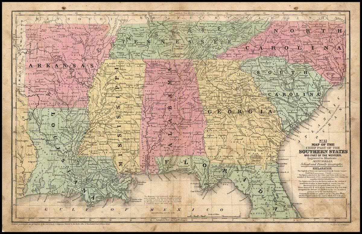
Map of the Chief Parts of the Southern States and part of the Western, 1858
Digital Record
Collection number: Map 1
Physical Description Note
1 map: color ; 26 x 41 cm Publisher: Philadelphia, PA; Mitchell, S. Augustus(Samuel Augustus), 1792-1868. Engraver: Williams , W. (Wellington) Scale: 1 : 3, 674, 880 Framed This map #12 was published in 1858 as part of Mitchell's School and Family Geography. Shows railroads, canals, populations and distances. Bottom of the map displays longitude from Washington, D.C., top of the map displays longitude from Greenwich.
Publisher Note
Publisher: Valdosta State University
Contributor Note
Contributor: Victoria Pennington
Repository Details
Part of the Valdosta State University Archives and Special Collections Repository
Contact:
Valdosta State University Archives, Odum Library
1500 N. Patterson St.
Valdosta GA 30601 United States
2293337150
229-259-5055 (Fax)
archives@valdosta.edu
Valdosta State University Archives, Odum Library
1500 N. Patterson St.
Valdosta GA 30601 United States
2293337150
229-259-5055 (Fax)
archives@valdosta.edu