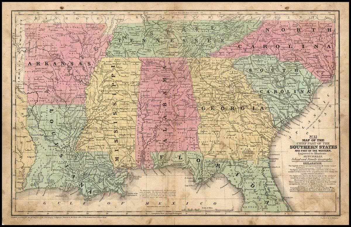
Map 1: Map of the Chief Parts of the Southern States and part of the Western, 1858
Item — Map: 1
Collection number: Map 1
Scope and Contents
1 map: color ; 26 x 41 cm Publisher: Philadelphia, PA; Mitchell, S. Augustus(Samuel Augustus), 1792-1868. Engraver: Williams , W. (Wellington) Scale: 1 : 3, 674, 880 This map #12 was published in 1858 as part of Mitchell's School and Family Geography. Shows railroads, canals, populations and distances. Bottom of the map displays longitude from Washington, D.C., top of the map displays longitude from Greenwich.
Dates
- 1858
Creator
- From the Collection: Mitchell, S. Augustus (Samuel Augustus), 1792-1868 (Cartographer, Person)
- From the Collection: Stuart, Oliver J. (Cartographer, Person)
- From the Collection: Lewis, Samuel (Cartographer, Person)
- From the Collection: Bellin, Jaques Nicolas, 1703-1772 (Cartographer, Person)
- From the Collection: Cram, George Franklin, 1841-1928 (Cartographer, Person)
- From the Collection: Jeffreys, Thomas, -1771 (Cartographer, Person)
- From the Collection: Ruscell, Girolamo, -approximately 1565 (Cartographer, Person)
- From the Collection: Sanuto, Gulio, 1520-1576 (Cartographer, Person)
- From the Collection: Sanuto, Livio, 1520-1576 (Cartographer, Person)
Conditions Governing Access
This collection is open for research.
Extent
From the Collection: 13.00 items
Language
From the Collection: English
Repository Details
Part of the Valdosta State University Archives and Special Collections Repository
Contact:
Valdosta State University Archives, Odum Library
1500 N. Patterson St.
Valdosta GA 30601 United States
7063728116
229-259-5055 (Fax)
archives@valdosta.edu
Valdosta State University Archives, Odum Library
1500 N. Patterson St.
Valdosta GA 30601 United States
7063728116
229-259-5055 (Fax)
archives@valdosta.edu